King Charles III England Coast Path
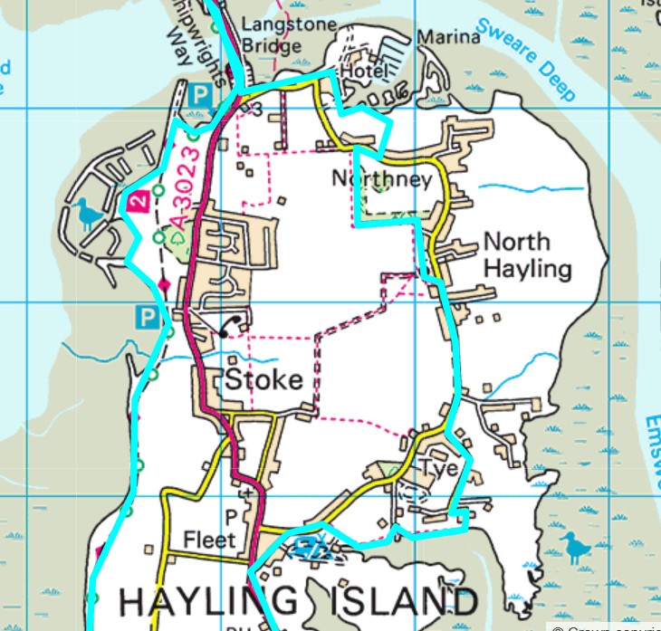
The new coastal path’s route through north east Hayling mainly follows inland public footpaths and St Peters Road and Copse Lane due to much of the coast being in private ownership. The map extract shows the two areas where the path follows the coast as the section from the bridge to Langstone Quay Resort, round the back of the marina to join Northney Road at the small car park; with the other coastal route around Yachthaven/Gutner
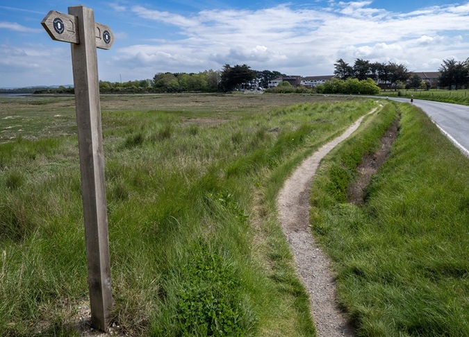
The section between the Wade Way layby and Langstone Quay resort is a mud bank that has provided some limited flood protection of Northney road. The mud bank also serves as a sort of footpath which has become unstable and steadily eroded over the years. The bank erosion is now so severe that it no longer prevents overtopping during seasonal spring tides and inclement weather therefore enabling frequent flooding of the road and is impassable and dangerous to motorists and pedestrians.
From 2012 the Association investigated and reported options to repair the bank and provide a stable and safe path. The Association developed a project proposal outlining all aspects required for repairs to be carried out including land ownership, design, construction, ecology, funding and discussions with the appropriate agencies.
The Association submitted a planning application for improvements to the path in 2016, with a revised scheme proposed in 2017 which was supported by Havant Borough Council. However, due to the highly sensitive ecological designations in that area Natural England blocked the proposal because of potential negative impacts on the Golden Samphire and other plants in the ditch. The Planning application was withdrawn. In 2018 Hampshire County Council were in discussion with Natural England about the coastal path and the possibility of reinstating the original path of 1m where possible, including levelling and surfacing.
Subsequently nothing was done to maintain the path by Hampshire County Council and the designation of the bank in 2026 as a key section of the King Charles III Coastal Path is generating an increase in footfall and increasing erosion on what has become a pedestrian hazard.
The increased use of the bank by pedestrians is a safety concern for the Association in terms of users of the path and their impact on undermining the fragile flood protection the bank provides. In 2024 NEHRA restarted efforts to improve flood mitigation and provide a safe path along this section of the road.